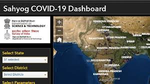
The Department of Science and Technology (DST), Government of India, developed mobile application SAHYO, an Integrated Geospatial Platform out of available geospatial datasets, standards-based services, and analytic tools. The mobile application and the website prepared and managed by the Survey of India (SoI)
Daily Current Affairs Quiz 2020
SAHYO:
♦ The SAHYO aims to help decision making during the COVID-19 pandemic.
♦ It will aid devising area-specific strategies to handle the socio-economic impact in the recovery phase.
♦ The platform will strengthen the public health delivery system of the Central and State Governments.
♦ It will provide the necessary geospatial information support to citizens and agencies dealing with the challenges related to socio-economic distress, health, and livelihood challenges.
♦ SAHYO is also available as a web portal in https://indiamaps.gov.in/soiapp/
♦ The app has been customized to collect COVID-19 specific geospatial datasets through community engagement to augment the response activities by the Government of India to the pandemic.
♦ Information parameters required as per the strategy of the Government of India strategy and containment plan for large outbreaks have been incorporated in the SAHYOG application.
♦ This integrated geospatial platform will strengthen India’s health emergency management due to the COVID-19 outbreak and support the socio-economic recovery process through the seamless provision of spatial data, information, and linkage between human, medical, technological, infrastructural and natural resources.


